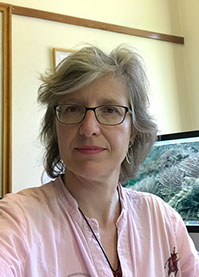
Aurélia Hubert-Ferrari
Bât. B11 Physical and Quaternary Geology Research group
Quartier Village 4
Clos Mercator 3
4000 Liège 1
Belgique
Tel.:+32 4 366 93 95
Email: aurelia.ferrari@uliege.be
Background
xxx
The research of Aurélia Hubert-Ferrari focuses on understanding tectonics and its interplay with geomorphological and sedimentological processes at different scales. She is specialized in exploiting relevant geophysical, sedimentological and geomorphological data to retrieve a history of deformation and earthquake shaking occurrence. For example in the Gulf of Corinth (Greece), her researches exploited, high-resolution seismic-reflection profiles to characterize the deformation and sedimentary processes at the tip of this intracontinental rift. Most of her work focuses on Asia and Europe.
xxx
Her recent achievements include (1) the characterization of deformation in different setting (extesional, translational and compressional) in the eastern Mediterranean and in the Tianshan (Western China), (2) obtaining paleoseismological records from different continental, lacustrine and marine setting.
xxx
As a geographer, she has furthermore been involved in other research projects dealing with a range of topics like assessing the geomorphic impacts of agricultural land use through history (Antakya, Southwestern Turkey), geotechnical mapping (Antananariva, Madagascar) and geoarcheology.
xxx
Some examples of her current research activities can be found here.
Carreer overview
2009 – …
2009 – 2005
2009 – 2008
2005 – 2002
2001 – 2000
1998 – 2000
1998 – 1994
1998 – 1995
1994 – 1993
1991 – 1995
Professor
Université de Liège, Department of Geography
Researcher and Team leader
Royal Observatory of Belgium
Marie Curie Excellence Grant untitled "Seismic Cycle" funded by the European Commission
CNRS Researcher (Chargé de Recherche de première classe)
Laboratoire de Géologie, Ecole Normale Supérieure de Paris
Postdoctoral fellow and lecturer
Institute of Geology, U. de Neuchâtel, Switzerland
FNS grant
Post-doctoral Research Associate
Department of Geosciences, Princeton University
National Science Foundation Grant
Post-doctoral Researcher
Department of Geosciences, Princeton University
Elf Inc. Post-doctoral fellow
PhD researcher
Institute of the Physics of the Globe of Paris (IPGP)
Title PhD thesis: Seismotectonics of the North Anatolian Fault (Estimation of its Quaternary slip rate and of its total displacement, and modeling of its propagation and of stress coupling between earthquakes)
Instructor in Geology
University of Paris 7-Denis Diderot.
Master in Geophysics
Institut de Physique du Globe de Paris and University of Paris 7-Denis Diderot. Title MSc. Thesis: Modeling of the 1981 Corinth earthquake sequence
Fellow of Ecole Normale Supérieure de Paris
Publications
xxx
Selection of key publications
xxx
Beckers, A., Hubert-Ferrari A., C. Beck, S. Bodeux, E. Tripsanas, D. Sakellariou, M. De Batist (2015) Active faulting at the western tip of the Gulf of Corinth, Greece, from high-resolution seismic data, Marine Geology 360, 55-69.
xxx
Drab L., A. Hubert-Ferrari, J. Carlut, M. El Ouhabi, S. Schmidt, P. Martinez, 2015, Submarine Paleo-earthquake record of the Cinarcik segment of the North Anatolian Fault in the Marmara Sea (Turkey), Bulletin Seismological Society of America 105, 622-645.
xxx
Hubert-Ferrari A., J. Suppe, R. Gonzalez-Mieres, 2007, Mechanisms of active folding of the landscape (Southern Tianshan, China), Journal of Geophysical Research, Volume 112, Issue B3, doi: 10.1029/2006JB004362.
xxx
Hubert-Ferrari A., R. Armijo, B. Meyer, G.C.P. King et A. Barka, 2002, Morphology, displacement and slip rates along the North Antolian Fault (Turkey), Journal of Geophysical Research, 107, 10.1029/2001JB000393.
xxx
Hubert-Ferrari A., A. Barka, E. Jacques, S. Nalbant, B. Meyer., R . Armijo, P. Tapponnier, G.C.P. King, 2000, Seismic hazard in the Sea of Marmata following the Izmit Earthquake, Nature, 404, 269-273.
Ongoing research projects
Paleo-tsunami and earthquake records of ruptures along the Nankai Trough, offshore South-Central Japan (Projet BRAIN QuakeRecNankai (Belspo) funded by the Belgium Sciences Policy Office)
xxx
For adequate hazard and risk assessments, the recurrence rate of the earthquakes needs to extend far enough in time to provide statistically relevant information. One of the goals of paleoseismological research is to generate a long time series of earthquake recurrences, in order to gain a better understanding of the complex recurrence patterns, both in space and in time.
xxx
The Brain QuakeNankai Project focuses on the Nankai-Suraga Trough subduction zone offshore the Central Southern Japan. This zone is expected to generate a megathrust earthquake and tsunami in the near future. To retrieve the long history of megathrust, the team at the University de Liège investigated the inland geological record of paleo-earthquakes in four lakes in the Mount Fuji area. We combined i) extensive fieldwork in collaboration with the U. of Gent (Prof. M. de Batist, Project leader), ii) advanced sedimentological and geochemical analyses, iii) dating techniques.
xxx
Our investigation of the lacustrine sediments from the Fuji Lakes shows that they were impacted by natural hazards such as earthquake shaking, typhoon-induced floods and volcanic eruptions. In the sedimentary infill of Lake Motosu, mass-transport deposits and turbidites triggered by earthquakes were recorded. Over the last ca. 6000 years, the mean recurrence time of seismic event triggering turbidites in Lake Motosu is 184±8 years. The lacustrine sediments collected in Lake Sai are a good archive for flood events. Detrital layers associated with the debris flow triggered by the 1966 Typhoon Ida (189 killed people, 3.9 millions Yens of damage) were identified, as well as other flood events associated with extreme precipitation events. Regarding volcanic eruptions, Lake Yamanaka and its catchment were repeatedly impacted by scoria fall-out due to their proximity to the Mt. Fuji volcano and the westerly wind direction. The last eruption (Hoei, A.D. 1707) strongly affected the lacustrine sedimentation and has a long-term effect on the catchment and on the lake, due to the sealing of the underlying sediments by the thick scoria layer.
xxx
The study of lacustrine sediments in order to retrieve a long-term paleoseismic record thus leads to broader results than the initial scope of the project. The full investigation of the sediments of Lake Sai and Kawaguchi still needs to be achieved. Our results need also to be combined with the tsunami record obtained onland by the Geological Survey (teams of Vanessa Heyvraert, Geological Survey of Belgium and of Marc de Batist, University of Gent) to work on risk and hazard assessment, combined with government policy support and public outreach.
xxx
The main foreign collaborators are: Osamu Fujiwara (National Institute of Advanced Industrial Science and Technology, Japan), Yusuke Yokoyama and Miyairi Yosuke (Tokyo University, Japan), Helmut Brückner (University of Cologne), Shiwa Yamamoto (Mount Fuji Research Institute)
